Last updated: November 4, 2026
I went looking for a place called Tampa Beach and never found it. The City of Tampa doesn't use that name for any stretch of sand. What the city has is four beaches along the shores of Tampa Bay, and they are a different thing from the wide Gulf strand most people picture when they type "tampa beaches" into a search box.
This guide sorts out what Tampa's beaches are, what they aren't, and where the Gulf sand is when that's what you came for. It's drawn from the City of Tampa's own beach pages and from what I worked out during my six months based downtown (November 2025 to May 2026), when I kept getting asked some version of "where's the beach?"
Why there is no beach called Tampa Beach
Tampa sits on Tampa Bay and the Hillsborough River. It is not on a Gulf barrier island. The postcard white sand is west, in Pinellas County, across the bridges. Searching for "tampa beach" folds three different things into one:
- Four city bay beaches that Tampa's Parks and Recreation department manages
- Bayshore Boulevard, the downtown waterfront walk, which is not a beach
- The Pinellas Gulf beaches, a drive away over the causeways
Once I kept those three separate, the whole question got easier. Calling all of it "Tampa Beach" is how visitors end up disappointed on a causeway, sand in view and no Gulf in sight.
All four city beaches are open sunrise to sunset. As of November 4, 2026, the city's beach pages list them as live, managed parks.
The four city-managed bay beaches
The City of Tampa names these four: Ben T. Davis, Cypress Point, Davis Islands, and Picnic Island. If you're searching for beaches in Tampa Florida proper, this is the complete city list.
Ben T. Davis Beach
Address: 7740 W. Courtney Campbell Causeway, 33607 Parking: Metered, $2.50 per hour
This is the one I think fools people most. It sits on the Courtney Campbell Causeway corridor, the same road that heads toward Clearwater. You can see sand and water out the window and think you've reached the Gulf. You haven't. It's a causeway beach on the bay, closer to the airport side of town than to Clearwater's Pier 60.
Cypress Point Park
Address: 5620 W. Cypress Street, 33607 Parking: Free Monday through Friday until noon. At other times it's metered: $1 for the first hour, then $2 for every hour after.
Cypress Point is the easy one to plan around if you can arrive on a weekday morning, since the free-parking window is generous. The city also lists a contracted SUP and beach yoga session on Sundays from 9 to 10 a.m. at Cypress Point. Confirm the current schedule on the city's beaches page before you plan around it, since contracted programs can change.
The park line is (813) 274-8615.
Davis Islands
Davis Islands is where I hit conflicting information, so I'm laying out both versions instead of blending them into one spot.
- The City of Tampa lists Davis Islands Seaplane Basin at 864 Severn Avenue, 33606, and doesn't describe the sand.
- Visit Tampa Bay lists Davis Islands Beach at 900 Martinique Avenue, Tampa, FL 33606, phone (813) 931-2121. Their description says anchored boats sometimes crowd the beach in front of this sandy spot near downtown, and that it may not be the best for swimming but is fine for reading or sunning.
I can't confirm those two addresses are the same patch of sand. Treat Davis Islands as a sit-and-look spot rather than a swim spot, and check the water-quality results below before you get in.
Picnic Island Park
Address: 7409 Picnic Island Boulevard, 33616 Hours: Park open sunrise to sunset; the boat ramp is open 24 hours Phone: Park Administration, (813) 274-8615
The city's page doesn't list a parking price for Picnic Island, so check with the park line before you go. What the city does list is a good set of amenities:
- A separate gated dog beach near the boat ramp and pier
- Sand volleyball
- Disc golf
- A playground
- A fishing pier
- A boat ramp, with 13 vehicle-with-trailer spaces and 30 vehicle-only spaces
Shelter reservations run through (813) 274-8184. If you're planning a group picnic, that's the number to call.
Check the water before you swim
This is the part I'd tell any visitor not to skip. The city points people to the Florida Department of Health's Healthy Beaches Program, which monitors Tampa's beach water, and tells you to check the latest test results before swimming at Ben T. Davis, Picnic Island, Cypress Point, or Davis Islands.
I find that more useful than any ranking. These beaches are real and sandy, but the city itself is saying the water is something you check, not something you assume. Look up the current results the same morning you plan to swim.
For park questions, the parks manager listed in my notes is John Dellaquilla, 813-753-9417, with the office at 3402 W. Columbus Drive.
Bayshore is the walk, not the swim
People point at Bayshore Boulevard when they say the beach is in Tampa. It isn't a beach, and it isn't one of the four city beaches. The city calls it the Bayshore Linear Park Trail:
- Address: 312 Bayshore Boulevard
- Hours: Sunrise to sunset
- Phone: (813) 274-8615
- Layout: A 10-foot-wide sidewalk running from Columbus Statue Park at Platt Street to Gandy Boulevard, plus a three-mile on-road bike lane on the northbound lane between Rome Avenue and Gandy
- Amenities the city names: Benches, a water fountain, bicycle parking, a city marina, and fitness stations
- Parking: Ballast Point Park and Fred Ball Park
- Rules: Fishing is not permitted along the trail
You can get on and off the route in a few ways: Coast Bike Share has a station at Rome Street, and a Pirate Water Taxi stop sits near the Platt Street Bridge at the Gasparilla ship dock.
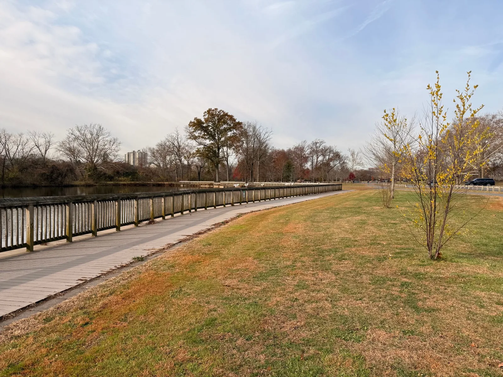
Hillsborough County describes the boulevard as looking over Hillsborough Bay with homes on the other side, and calls its 4.5-mile continuous sidewalk the longest in the country. The county mentions dolphins, manatees, rays, and herons along the way. The seawall is flood protection, not a shore you swim from. The view is the trap here: there is nowhere to put a towel. Come for the sunset walk, not the beach day.
If you want a downtown water path that isn't a swimming beach, the Tampa Riverwalk is the other one to know about.
Gulf beaches near Tampa
If the sugar-sand Gulf beach is what you're really after, these are the beaches near Tampa that people actually mean. All of them are in Pinellas County, west of the city. The Tampa to Clearwater guide covers that drive in more detail.
Clearwater Beach
Visit Florida says Clearwater Beach is about 25 miles west of Tampa, and the drive usually takes about 30 to 40 minutes depending on traffic, via FL-60 west across the Courtney Campbell Causeway. That's the same causeway as Ben T. Davis, which is exactly why the two get confused.
Clearwater Beach is in Pinellas County, west of Tampa and north of St. Petersburg, reached over the Clearwater Memorial Causeway. Visit Florida mentions Pier 60's nightly sunset, a 2018 number-one beach ranking, and Dr. Beach naming Caladesi in 2008. The "35 miles of sugar-sand" line describes the Pinellas coast as a whole, not one beach. The airports Visit Florida names are Tampa International and St. Pete-Clearwater.
Parking is the part not to shrug off. The City of Clearwater says to get there early.
- Pier 60 lot: 160 S. Gulfview Boulevard, 141 spaces at $3.50 per hour, 6 a.m. to 11 p.m.
- On-street: $4.00 per hour with a five-hour limit
- How to pay: A kiosk, ParkMobile, or text CLEARWATER to 727563
- Restrictions: No RV parking on the beach streets, and nothing public north of the Acacia Roundabout
- Hotline: (727) 562-4094, weekdays 8 to 4
Private garages say to call for rates, so I'm not quoting one. The real struggle is noon on a Saturday, not the hourly rate.
Indian Rocks Beach
Visit Florida places Indian Rocks Beach in Pinellas County on the Gulf, between Clearwater and St. Petersburg, approximately 27 miles west of Tampa, with a typical drive of about 40 to 50 minutes depending on traffic. They mention shells, a seabird sanctuary you can walk to, a mangrove boardwalk, and a Mobi-mat onto the sand, and they call it laid-back. That's their adjective, not a ranking I measured, but it's why I'd point someone here instead of Pier 60 if crowds are the concern. I wasn't given a parking rate, so check before you go.
Fort De Soto Park
Fort De Soto is the one locals mean and visitors miss, because the name doesn't say Tampa. Pinellas County lists it at 3500 Pinellas Bayway South, Tierra Verde.
- 1,136 acres across five keys, with over 7 miles of waterfront including almost three miles of beach
- Open 7 a.m. to sunset
- Parking is $6, plus $0.35 if you pay by app or text
- Loggerhead turtles nest April through September
- More than 328 bird species recorded, and attendance averages more than 2.7 million
- Fishing piers require a license
- Dogs are allowed on the sand only in the designated dog-beach area
- Concessions are cashless
Visit Florida's directions: take I-275 to exit 17, head west, and turn left at the second light onto State Road 679. From the Gulf beaches, go south through St. Pete Beach, turn left on the Pinellas Bayway, then right on 679.
The sources disagree on some Fort De Soto figures. The county says almost three miles of beach; Visit Florida says over six miles. The county says 236 campsites; Visit Florida says 238, all with water and electric. Both mention Dr. Beach's number-one ranking in 2005. If you plan to camp, book through the county.
I wasn't given a mile count from downtown Tampa to Fort De Soto or to St. Pete Beach, so I'm not writing one. Use a map app for the day you go, or open the Tampa map to see how the causeways and bridges connect.
So which is the best beach in Tampa?
If someone in a Tampa hotel asks me for the best beach in Tampa Florida, my honest answer is that the city has four bay beaches and none of them is the postcard. Here's how I'd sort it:
- Want sand close to home on a budget? Cypress Point on a weekday morning, when parking is free until noon.
- Bringing a dog or a crowd? Picnic Island, with its separate dog beach, shelters, and play areas.
- Want to sit and look at the water? Davis Islands, keeping in mind the swimming caveat.
- Want the Gulf? Budget the Courtney Campbell to Clearwater and arrive early, keep going to Indian Rocks for something quieter, or head south to Fort De Soto and pay the $6.
- Want a sunset walk with no sand in the car? Bayshore.
If you're still getting oriented to the area as a whole, the Tampa Florida overview is the place to start.
Quick tips
- Check the Florida Healthy Beaches results the day you swim at any of the four city beaches.
- Cypress Point parking is free Monday to Friday until noon.
- Ben T. Davis is a bay beach on a causeway, not the Gulf.
- Gulf beaches fill up. Get to Clearwater early, especially on weekends.
- Verify anything time-sensitive, like the Sunday SUP yoga schedule, on the city's beaches page.
FAQ
Is there a Tampa Beach? Not as a named place. The City of Tampa doesn't use "Tampa Beach" for any strand. It manages four bay beaches: Ben T. Davis, Cypress Point, Davis Islands, and Picnic Island.
Are Tampa's beaches on the Gulf of Mexico? No. They sit on Tampa Bay. The Gulf beaches are in Pinellas County, to the west.
How far is Clearwater Beach from Tampa? Visit Florida says about 25 miles, usually a 30 to 40 minute drive depending on traffic, via FL-60 west across the Courtney Campbell Causeway.
What are the beach hours? The city lists all four beaches as open sunrise to sunset. At Picnic Island the boat ramp is open 24 hours.
Is Bayshore Boulevard a beach? No. It's a waterfront sidewalk and trail along a seawall, good for walking, biking, and sunsets, but not for swimming.
Where can I check water quality? The city directs visitors to the Florida Department of Health's Healthy Beaches Program for current test results before swimming.
For the city's own beach listings, see the City of Tampa beaches page and the Picnic Island Park page.